New Features on TripCheck
Mountain Passes

TripCheck’s new Mountain Passes pages bring the travel information you need for Oregon’s mountain routes together in one place. Start with an overview of available passes, then open a pass for current conditions and location-specific details.
Mountain Pass Highlights
- Current travel conditions: Review road and weather reports, chain restrictions, and active snow zone information.
- Cameras and maps: View current camera images and a snapshot map showing nearby cameras and automated weather stations.
- RWIS observations: Check air and road-surface temperatures, visibility, wind, and milepost-specific station readings where available.
- High Wind Alerts: Yellow and red alerts call attention to elevated current wind gusts reported by nearby RWIS stations. These are TripCheck travel alerts, not official weather warnings.
- Pass details: Find elevation, maximum grade, milepost ranges, regional information, and travel times where available.
- Road Conditions map: Select Mountain Pass markers for detailed condition, camera, RWIS, and snow zone information without leaving the map.
Custom Camera Improvements
Custom Camera pages now support up to 25 cameras. Their web addresses include the selected camera IDs, making a custom view easy to bookmark or share with friends. Cameras can also be removed directly from a preview or saved page by selecting the trash icon in the upper-right corner of an image; save or update the page to keep the revised camera list.
Introducing Our New “Conditional Closure” Alerts
We’re excited to announce a new type of travel impact on our website: Conditional Closures (CC). These alerts help you see when certain types of vehicles can still travel through areas affected by hazards, while others may be restricted.
What Are Conditional Closures?
A Conditional Closure means a road or highway is partially closed based on vehicle type or other specific restrictions. For example:
- Minor flooding may lead to a closure for low-clearance vehicles, but trucks or high-clearance vehicles can still pass.
- High winds may result in a closure for high-profile vehicles (such as RVs, box trucks, or trailers) to reduce blow-over risk.
- Local traffic only closures could restrict everyone except drivers who live or work in the area.
- Chain condition requirements might close the road to unchained vehicles when chains are mandatory.
How Will I Know It’s a Conditional Closure?
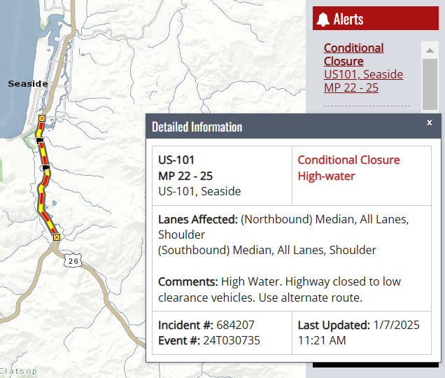
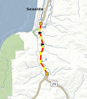
- On the Map: You’ll see a new red and yellow “striped” line indicating a Conditional Closure. This is different from our standard closure line, which remains red and white.
- Alerts Section: Look for the “CC” label in TripCheck alerts for up-to-the-minute information on these partial closures.